- 遥感大数据分析
- 遥感AI
- 地理空间智能研究
- 遥感社会地理计算
Director
王少华
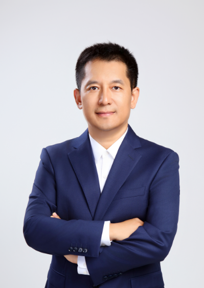
王少华
中国科学院空天信息创新研究院
研究员
个人简介
王少华,博士,中国科学院空天信息创新研究院研究员,博士生导师,遥感和数字地球全国重点实验室副主任。研究方向为遥感大数据分析和遥感AI、地理空间智能和遥感社会地理计算。
回国前曾先后在美国加州大学圣塔芭芭拉分校地理系、亚利桑那州立大学SPARC中心和伊利诺伊厄巴纳香槟分校CyberGIS中心担任博士后研究员。
获得中国地理信息科技进步特等奖、北京市科学技术一等奖等。近年来发表学术论文200余篇,以第一作者或通讯作者在IEEE-TGRS、IJGIS、JAG、SCS等国际期刊发表SCI/SSCI文章70余篇。
中国遥感应用协会社会遥感地理计算副理事长、国际华人地理信息科学协会(简称 CPGIS) BOD、中国地理信息产业协会兼职研究员、中国自然资源学会资源制图专业委员会委员。
研究方向
教育经历
-
2008-09至2013-06, 中国科学院地理科学与资源研究所,地图学与地理信息系统,理学博士
-
2002-09至2006-06, 北京化工大学,信息与计算科学,理学学士
从业经历
-
2024-12至今, 中国科学院空天信息创新研究院 研究员
-
2021-09至2024-12, 中国科学院空天信息创新研究院 创新研究员
-
2019-08至2021-09, 美国伊利诺伊大学厄巴纳-香槟分校CyberGIS Center
-
2018-07至2019-08, 美国亚利桑那州立大学SPARC中心
-
2016-04至2018-07, 美国加州大学圣塔芭芭拉分校地理系
-
2013-09至2016-04, 中国科学院地理科学与资源研究所
-
2006-07至2008-08, 北京超图软件股份有限公司超图研究院 软件工程师
代表性论文
第一作者代表性论文
- Wang S*, Su C, Zhao Z*, et al. HiSpot: an integrated and accessible Python framework for spatial optimization in urban analytics[J]. International Journal of Digital Earth, 2026.
- Wang S*, Yang X, Zheng J, et al. Gold Prospectivity Mapping Based on the Integration of ZY-1 02D Hyperspectral Imagery and Deep Learning in the Siguiri Basin, West Africa[J]. IEEE Journal of Selected Topics in Applied Earth Observations and Remote Sensing, 2026.
- Wang S, Zhou J*, Liang H, et al. Optimization of urban service facility allocation for the SDGs: current status, innovations, and prospects[J]. Sustainable Cities and Society, 2026.
- 王少华*, 梁浩健, 苏澄, 等. 耦合时空大数据和人工智能的城市设施配置优化研究进展与展望[J]. 测绘学报, 2026.
- Wang S*, Xu D, Liang H, et al. Advances in deep learning applications for plant disease and pest detection: A review[J]. Remote Sensing, 2025, 17(4): 698.
- Wang S, Wang Y, Yue J*, et al. UniU-Net: A Unified U-Net Deep Learning Approach for High-Precision Areca Palm Segmentation in Remote Sensing Imagery[J]. Applied Sciences, 2025, 15(9): 4813.
- Wang S, Li X, Lin L, et al. A Single Data Extraction Algorithm for Oblique Photographic Data Based on the U-Net[J]. Remote Sensing, 2024, 16(6): 979.
- Wang S, Qi H, Li T, et al. Can normalized difference vegetation index and climate data be used to estimate soil carbon, nitrogen, phosphorus and their ratios in Xizang's grasslands?[J]. Frontiers in Earth Science, 2024, 11: 1340020.
- Wang S, Fu G*. Modelling soil moisture using climate data and normalized difference vegetation index based on nine algorithms in alpine grasslands[J]. Frontiers in Environmental Science, 2023, 11: 1130448.
- Wang S, Sun Y*, Sun Y, et al. A Hybrid Framework for High-Performance Modeling of Three-Dimensional Pipe Networks[J]. ISPRS International Journal of Geo-Information, 2019, 8(10): 441.
- Wang S, Wang Y*, Hu Q*, et al. Unmanned aerial vehicle and structure-from-motion photogrammetry for three-dimensional documentation and digital rubbing of the Zuo River Valley rock paintings[J]. Archaeological Prospection, 2019.
- Wang S*, Zhong Y, Wang E. An integrated GIS platform architecture for spatiotemporal big data[J]. Future Generation Computer Systems, 2019, 94: 160-172.
- 王少华, 钟耳顺*, 廖华军, 等. 基于邻近图的道路网络特征分析[J]. 测绘通报, 2017.
- Wang S, Zhong E*, Li K, Song G, Cai W*. A novel dynamic physical storage model for vehicle navigation maps[J]. ISPRS International Journal of Geo-Information, 2016, 5(4): 53.
- Wang S*, Su C, Pan Y, et al. Optimization of Location Selection for Fengchao Cabinets in Beijing Based on Deep Reinforcement Learning[C]. DeepSpatial '24, Barcelona, Spain, 2024.
- Wang S*, Xu D, Zhou J, et al. Convenience Stores Geospatial Location Optimization Analytics Using Deep Reinforcement Learning[C]//Proceedings of the 3rd ACM SIGSPATIAL International Workshop on Spatial Big Data and AI for Industrial Applications. 2024.
- Wang S*, Liang X, Zhou L, et al. Optimization of Site Selection for Free-Floating Shared Electric Vehicles Based on Deep Reinforcement Learning[C]//2nd ACM SIGSPATIAL International Workshop on Advances in Urban-AI. 2024.
- Wang S*, Zhang Z, Su C, et al. Spatial Optimization Site Selection of Beijing Cainiao Station Based on Multi-Source Geospatial Data[C]//Proceedings of the 1st ACM SIGSPATIAL International Workshop on Geocomputational Analysis of Socio-Economic Data. 2023: 20-23.
- Wang S*, Su C, Zhou J, et al. Analysis of the Distribution Characteristics and Influencing Factors of Advertising Billboards in Wuhan[C]//Proceedings of the 7th ACM SIGSPATIAL Workshop on Location-based Recommendations, Geosocial Networks and Geoadvertising. 2023: 6-14.
- Wang S*, Liang H, Zhong Y, et al. DeepMCLP: Solving the MCLP with Deep Reinforcement Learning for Urban Spatial Computing[C]//Spatial Data Science Symposium 2023 Short Paper Proceedings. 2023.
通讯作者代表性论文
- Guan X, Liang W, Xu M*, Wang S*, et al. Remote Sensing Diagnosis of Vegetation Dynamics in the Three-North Shelterbelt Program Area[J]. IEEE Transactions on Geoscience and Remote Sensing, 2026.
- Xie Y, Wang H, Liang H, Wang S*, et al. Care-Net: deep reinforcement learning for distance-decay maximal covering of elderly care facility location considering multi-attribute site suitability[J]. Geo-spatial Information Science, 2026.
- Xu D, Wang S*, Liang H, et al. Optimizing waste bin allocation in the Mount Yun scenic area: a data-driven approach based on the stage-weighted covering location model[J]. International Journal of Digital Earth, 2026.
- Huang Z, Wang S*, Liang H, et al. Recursive hierarchical facility optimization for enhancing retail equity: A consumer-centric case in China's 4 state-level new districts[J]. Journal of Retailing and Consumer Services, 2026.
- Wang P, Hu Q, Mei Q, Wang S*, et al. Intelligent port logistics: A spatiotemporal knowledge graph and AI-agent framework for berth allocation[J]. Advanced Engineering Informatics, 2025.
- Liang X, Zhou L, Wang S*, et al. Spatiotemporal crime prediction and fairness-constrained spatial optimization with deep reinforcement learning for patrol region design[J]. International Journal of Applied Earth Observation and Geoinformation, 2025.
- Yue J, Wang Y, Pan J*, Liang H, Wang S*, et al. Less Is More: A Lightweight Deep Learning Network for Remote Sensing Imagery Segmentation[J]. IEEE Transactions on Geoscience and Remote Sensing, 2025.
- Liang H, Wang S*, Li H, et al. AIAM: Adaptive interactive attention model for solving p-Median problem via deep reinforcement learning[J]. International Journal of Applied Earth Observation and Geoinformation, 2025, 138: 104454.
- Liu X, Hu J, Mei Q, Wang S*. Pirate-GPT: A locally deployed large language model framework for reliable offline anti-piracy decision support and knowledge retrieval in maritime operations[J]. Reliability Engineering & System Safety, 2025.
- Lin S, Li Y, Hu Y, Shi J, Wang S*, et al. Research on ship dynamic feature extraction and prediction method based on visual data[J]. Ocean Engineering, 2025.
- Zhao Z, Wang S*, Su C, et al. Multi-Size Facility Allocation Under Competition: A Model with Competitive Decay and Reinforcement Learning-Enhanced Genetic Algorithm[J]. ISPRS International Journal of Geo-Information, 2025, 14(9): 347.
- Song S, Wang S*, Li X, et al. An investigation into the spatial distribution patterns and influencing factors of fortresses in Tianshui, Gansu Province, China[J]. Humanities and Social Sciences Communications, 2025, 12: 1337.
- Su C, Zhong E, Wang S*, et al. Geospatial information technology: analysis of architectural characteristics from vertical and horizontal perspectives and intelligent-driven application modes[J]. International Journal of Digital Earth, 2025, 18(1): 2528634.
- Liang H, Wang S*, Li H, et al. BIGNN: Bipartite Graph Neural Network with Attention Mechanism for Solving Multiple Traveling Salesman Problems in Urban Logistics[J]. International Journal of Applied Earth Observation and Geoinformation, 2024.
- Zhang Y, Wang S*, Liang H, et al. Dual hybrid frameworks combining graph convolutional network with decoding for covering location problem[J]. iScience, 2024.
- Zhong Y, Wang S*, Liang H, et al. ReCovNet: Reinforcement learning with covering information for solving maximal coverage billboards location problem[J]. International Journal of Applied Earth Observation and Geoinformation, 2024, 128: 103710.
- Liang H, Wang S*, Li H, et al. Sponet: solve spatial optimization problem using deep reinforcement learning for urban spatial decision analysis[J]. International Journal of Digital Earth, 2024, 17(1): 2299211.
- Chen X, Wang S*, Li H, et al. An attention model with multiple decoders for solving p-Center problems[J]. International Journal of Applied Earth Observation and Geoinformation, 2023, 125: 103526.
- Nie S, Cai G*, He J, Wang S*, et al. Economic costs and environmental benefits of deploying CCUS supply chains at scale: Insights from the source–sink matching LCA–MILP approach[J]. Fuel, 2023, 344: 128047.
- Sun Y, Wang S*, Zhang X, Chan T O, Wu W*. Estimating local-scale domestic electricity energy consumption using demographic, nighttime light imagery and Twitter data[J]. Energy, 2021, 226: 120351.
科研项目
[1] 北京市朝阳区协同创新项目,2022.07-2023.06,“地理空间智能模型与GIS平台高效嵌入关键技术研发与应用”
[2] 海南省自然科学基金面上项目,2023.01-2024.12 ,耦合遥感大数据和空间智能的槟榔黄化病预测预报方法研究
[3] 北京市传感器重点实验室开放课题,2022.07-2023.06 “面向复杂情景的声传感器的特征分析及配置优化”
[4] 国家测绘局测绘公益项目,2015.01-2016.12,“地理空间数据内容模型与存储格式标准化研究”课题-GIS数据格式检查软件
[5] 北京市优秀人才资助项目,2015.01-2016.12,“面向大数据的商业地理信息系统关键技术研究”
[6] 中国营养学术开放课题,2016.01-2016.12, “中国儿童营养地图”
[7] 北京市科委科技创新战略研究及专家咨询专项研究课题,2015.03-2015.12,“京津冀空间信息产业一体化发展专题调研”
[8] 北京市科委新技术培育项目,2015.01-2016.04,面向海量地理信息数据存储和并行空间分析的高性能GIS系统研制
申请或授权发明专利
[1] 基于消息的分布式空间数据处理系统,授权专利(ZL201610864468.4)
[2] 一种GIS软件中针对大数据的可视化管理方法,授权专利(ZL201611182291.6)
获奖情况
1.基于大数据的城市全量建筑动态监测关键技术与应用,中国地理信息产业协会,地理信息科技进步奖获奖,二等奖,2023(牛锐,黄迎春,张劲松,王涨,靖常峰,杨伯钢,吴军,霍春雷,耿源浩,王少华)
2. 云端一体化SuperMapGIS软件平台研发及产业化,北京市人民政府,科学技术奖,一等奖,2015(钟耳顺、宋关福、王尔琪、李绍俊、梁军、胡中南、谢林、冯振华、曾志明、王少华、卢浩、周芹、李文龙、周旭、李少杰)
3. 云端一体化SuperMap GIS软件平台研发及产业化, 中国地理信息产业协会, 科技进步奖, 省部特等奖, 2014 (钟耳顺; 宋关福; 王尔琪; 李绍俊; 梁 军; 胡中南; 谢 林; 冯振华; 曾志明; 王少华; 卢 浩; 周 芹; 周 旭; 黄 骞; 莫洪源; 丁晶晶; 苏乐乐; 李文龙; 金建波; 胡辰璞; 石伟伟; 孙寅乐; 饶庆云; 云惟英; 李少杰; 周 强; 谷永权; 李玮顾; 王天宝; 张艳良).